
What comes to mind when you think of Seoul? Seoul Tower, the Han River, Gyeongbokgung Palace — or Gangnam Station?
Seoul is South Korea’s biggest city, but it’s closer to a patchwork of several dozen different towns stitched into one. The city covers about 605 square kilometers (0.6% of the country’s territory) and is home to roughly 9.28 million people as of July 2026 (resident registration figures). All of them are packed into 25 districts, called gu, and every single gu has its own character: different streets, different food, different daily rhythm.
The Han River: Seoul’s Great Divide
Seoul’s geography is easy to read. Bukhansan (북한산) Mountain and Namsan (남산) Mountain guard the north, Gwanaksan (관악산) Mountain anchors the south, and the Han River (한강) cuts through the middle from west to east. The river is the city’s unofficial border.
North of the river, Gangbuk (강북), is the old city — 600 years of palaces, markets, and narrow alleys. South of the river, Gangnam(강남), was mostly rice fields until the 1970s, when it was built up into a modern metropolis almost overnight. Fourteen gu sit on the northern side, eleven on the southern, and their personalities could hardly be more different.
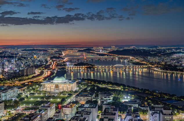
Photo: Korea Tourism Organization
The Historic Core: Jongno-gu & Jung-gu (종로구, 중구)
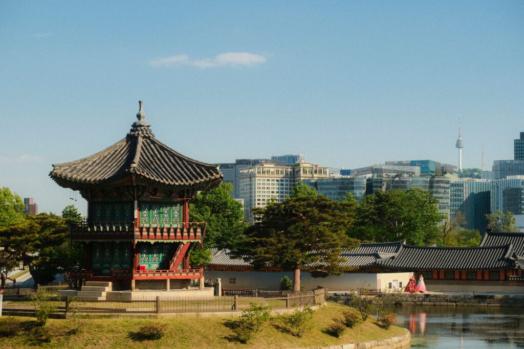
Jongno-gu is Seoul’s historic heart. This is where the Joseon capital was laid out in 1394, and the evidence is everywhere: Gyeongbokgung Palace and Gwanghwamun Gate, Changdeokgung Palace and Jongmyo Shrine (both UNESCO World Heritage sites), the Bukchon hanok village, Insadong’s antique shops and teahouses, and Cheonggyecheon, the restored stream running through downtown. By day the neighborhood belongs to history and the government offices of Gwanghwamun; after dark, the unmarked bars and snack tents of Euljiro’s alleys take over.
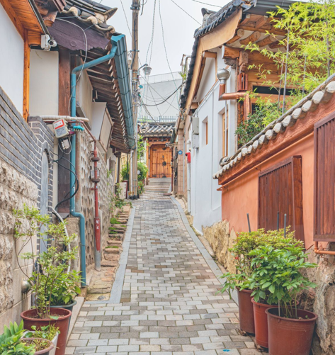
Photo: Korea Tourism Organization
Jung-gu, its neighbor, is Seoul’s commercial beating heart. Myeong-dong is the country’s most famous shopping street, Namdaemun Market has been selling food, fabric and everyday goods for over 600 years, and Deoksugung Palace sits in the middle of downtown as a quiet green surprise. N Seoul Tower watches over the city from Namsan, while the futuristic DDP plaza anchors the eastern end of downtown. Together, these two gu are the “old city” people picture when they think of Seoul.
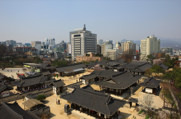
Photo: Korea Tourism Organization
Around Namsan and the River: Yongsan-gu (용산구)
Yongsan-gu is where Seoul becomes thoroughly international. Itaewon is the city’s most multicultural street, and Gyeongnidan-gil and Hannam-dong have become hotspots of fashionable cafes and boutiques. The former Yongsan Garrison, returned by the US military, is being transformed into Yongsan Park, among the largest urban parks ever planned in Seoul, with the National Museum of Korea already standing next door. The legendary Yongsan Electronics Market is where Seoul goes to buy gadgets, and Seoul Station anchors the district’s southern edge.
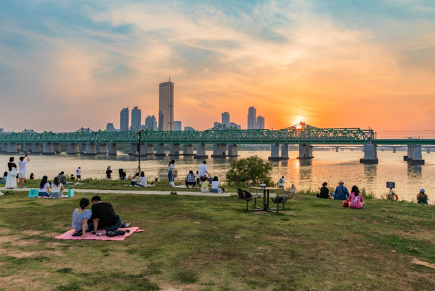
Photo: Korea Tourism Organization
The Youth Belt of the Northwest: Mapo-gu, Seodaemun-gu & Eunpyeong-gu (마포구, 서대문구, 은평구)
Mapo-gu may be the youngest-feeling district in all of Seoul. Hongdae, around Hongik University, is the city’s indie-music and nightlife capital, with clubs, flea markets and street performances every weekend. Yeonnam-dong overflows with picture-perfect cafes, Mangwon-dong is famous for its food street, and Mangwon Hangang Park is the city’s favorite summer picnic spot. Farther west, Sangam’s DMC (Digital Media City) is home to media companies and the Seoul World Cup Stadium.
Seodaemun-gu blends education and history. Sinchon, home to Yonsei and Ewha Womans universities, is Seoul’s classic university town — theaters, indie bookshops and budget restaurants line the streets. Seodaemun Independence Park and the Seodaemun Prison History Hall preserve the painful memory of the Japanese colonial era, while Ansan, a gentle hillside park, offers easy walks with views over downtown.
Eunpyeong-gu, tucked against the western slopes of Bukhansan, is a family-friendly residential district. Eunpyeong New Town is a large, modern quarter of apartment complexes, and Eunpyeong Hanok Village, opened in 2014, lets you experience traditional wooden houses without the crowds of Bukchon. Bukhansan’s hiking trails begin right at the district’s northern edge.
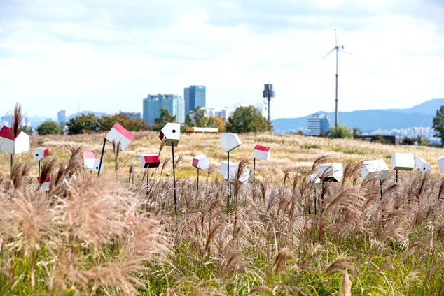
Photo: Korea Tourism Organization
The Quiet Northern Hills: Seongbuk-gu, Gangbuk-gu, Dobong-gu, Nowon-gu, Jungnang-gu & Dongdaemun-gu (성북구, 강북구, 도봉구, 노원구, 중랑구, 동대문구)
Seongbuk-gu is Seoul’s scholarly hill district. Korea University and several other campuses sit here, while the hillsides of Seongbuk-dong and Jeongneung are lined with traditional homes, art galleries and quiet cafes. Trails lead up Naksan and along the restored Seoul City Wall, and the whole neighborhood feels a world away from downtown.
Gangbuk-gu, directly north of Seongbuk, is a laid-back residential area against Bukhansan. Suyu-dong’s food street is where locals end a long night with grilled meat, and the 4.19 National Cemetery commemorates the students who gave their lives in the 1960 pro-democracy movement.
Dobong-gu is Seoul’s northernmost residential corner. Dobongsan, one of the city’s most loved hiking mountains, rises at its edge; nearby, Chang-dong acts as a busy transit hub. It’s a quiet, family-oriented district with none of the downtown frenzy.
Nowon-gu is among the most densely populated residential districts in the country. The streets around Nowon Station form a famous hagwon (cram school) area — one of several education streets Korean parents know by name — while Surak and Bulam mountains offer easy weekend hikes. Taereung, a serene cluster of royal tombs, and Seoul National University of Science and Technology sit in the district’s south.
Jungnang-gu is a compact residential district in the northeast. Daily life revolves around the large apartment complexes of Myeonmok-dong, the bike paths along the Jungnangcheon stream, and easy hills like Bonghwasan. It’s a classic commuter town tucked inside the city.
Dongdaemun-gu is Seoul’s eastern gateway. Cheongnyangni, historically one of the country’s largest railway and market hubs, is undergoing large-scale redevelopment into a new commercial and residential center, while Kyung Hee University brings a lively student crowd to Hwigyeong-dong. The district takes its name from the Great East Gate of the old capital nearby.
The Trendy Eastern Riverside: Seongdong-gu & Gwangjin-gu (성동구, 광진구)
Seongdong-gu is home to Seongsu-dong, often called “Seoul’s Brooklyn.” What was once a shoe-factory district is now the city’s trendiest streetscape: independent cafes, design studios, workshops and microbreweries fill converted factories. Seoul Forest, a riverside park of about 1.16 million square meters, is one of the best places in the city to picnic or watch the seasons change, and Ttukseom Hangang Park bursts into life with concerts and festivals every summer.
Gwangjin-gu sits on the wide bend of the river, centered on Konkuk University and its always-busy station district. Children’s Grand Park is a favorite family destination, the container-built shopping landmark Common Ground anchors the area’s quirky retail scene, and the hills of Achasan offer short, popular hikes right inside the city.
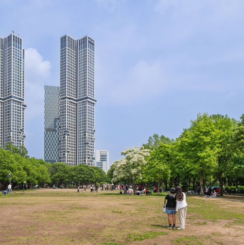
Photo: Korea Tourism Organization
Seoul’s Southwestern Engine: Yeongdeungpo-gu, Guro-gu, Geumcheon-gu, Yangcheon-gu, Gangseo-gu, Dongjak-gu & Gwanak-gu (영등포구, 구로구, 금천구, 양천구, 강서구, 동작구, 관악구)
Yeongdeungpo-gu tells the story of Seoul’s industrialization better than any other district. Its riverside core, Yeouido, is the country’s financial and political capital — the National Assembly, major securities firms and the KBS headquarters share the island, and the riverside cherry-blossom avenue is a spring spectacle. Times Square, one of Seoul’s biggest malls, dominates the old town center. Mullae-dong, once a steel-working quarter, has become a creative village of design studios and cafes, and Daerim-dong is Seoul’s de facto Chinatown, famous for authentic Chinese restaurants. Seonyudo, a former water-treatment plant turned riverside park, is one of Seoul’s most beloved escapes.
Guro-gu was once the heart of Seoul’s textile and manufacturing industry, and its Guro Digital Complex now houses thousands of IT companies in the city’s first digital-industry district. Gocheok Sky Dome, a major baseball stadium, rises beside it, and the shopping-and-dining hub of Sindorim Station sits right next door.
Geumcheon-gu, the city’s southernmost district, carries on the same industrial lineage: Gasan Digital Complex, part of the same digital valley, is packed with tech offices, showrooms and outlet cafes. Beyond the office towers, the hillside neighborhoods of Sihung and Doksan are friendly, residential corners.
Yangcheon-gu is dominated by Mok-dong, one of the most famous education districts in Korea. The vast Mok-dong apartment complex is surrounded by thousands of hagwon, making the area a byword for academic ambition — and it also enjoys excellent riverside walks along the Anyangcheon stream and the small, French-themed Paris Park.
Gangseo-gu is Seoul’s far-western gateway, where Gimpo Airport handles domestic routes and flights to China and Japan. The district is currently one of Seoul’s fastest-changing: Magok-dong, once farmland, has been transformed into a clean new city-quarter with the LG Science Park, wide boulevards and fashionable cafes. With about 550,000 residents, Gangseo is the third most populous district in Seoul.
Dongjak-gu is a riverside district of universities and exam dreams. Noryangjin is Seoul’s “exam village,” where tens of thousands of students preparing for civil-service and bar exams crowd tiny single rooms — and its fish market is one of the largest and liveliest in the country. Chung-Ang and Soongsil universities add a young energy, and Boramae Park is a beloved family park at the district’s heart.
Gwanak-gu is the hill of Seoul National University. The university’s forested main campus, with Gwanaksan rising behind it, is the district’s giant green heart, and the student streets of Sillim-dong and Nakseongdae hum with cheap restaurants, cafes and new youth-culture shops. Gwanaksan itself is one of Seoul’s most popular hiking mountains, with stunning views of southern Seoul from its summit.
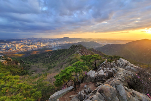
Photo: Korea Tourism Organization
The Gangnam Realm: Gangnam-gu, Seocho-gu, Songpa-gu & Gangdong-gu (강남구, 서초구, 송파구, 강동구)
Gangnam-gu is the symbol of modern Seoul — the “Gangnam” of the global hit song. Gangnam Station is one of the busiest intersections in the nation, Teheran-ro is the city’s tech-and-finance valley, and the Coex area around Samsung Station, including the spectacular Starfield Library, pulls in crowds by the thousands. Apgujeong and Cheongdam are luxury shopping and entertainment districts, home to K-pop agencies and celebrity-frequented restaurants, while Daechi-dong is the country’s most famous cram-school neighborhood. Quiet pockets like Dosan Park and the tree-lined Garosu-gil street balance out the frenzy.
Seocho-gu is Gangnam’s more refined neighbor. The area around Seocho Station is Korea’s legal district — the Supreme Court, the prosecutors’ offices and the country’s top law firms cluster here. Yangjae hosts a massive wholesale flower market; Banpo Hangang Park, with its rainbow fountain over the river and the floating Sevit Islands, is one of the most photographed spots in Seoul; and Seorae Village, a French expat enclave, has some of the city’s best bakeries. The Express Bus Terminal area is a shopping powerhouse.
Songpa-gu is Seoul’s most populous district, home to about 650,000 residents — and it has the tourism infrastructure to match. Jamsil is built around Lotte World theme park and Lotte World Tower, Korea’s tallest building, set beside Seokchon Lake with its cherry blossoms and lotus ponds. Olympic Park, created for the 1988 Summer Games, is now a vast landscape of meadows, walking paths and concert venues. Garak Market, the country’s largest wholesale food market, keeps the district’s down-to-earth side alive, and the Baekje-era Mongchon Fortress stands as a 2,000-year-old reminder of what occupied this land long before.
Gangdong-gu, the easternmost district, is where Seoul’s oldest history and newest apartments meet. Pungnap Fortress and the Amsa-dong prehistoric site, a Neolithic settlement from around 4,000 B.C., make this the ground of ancient Baekje’s first capital, Wiryeseong. Today the district is known for new residential complexes along the Han River, the riverside Gwangnaru park, and the bustling commercial streets of Cheonho-dong.
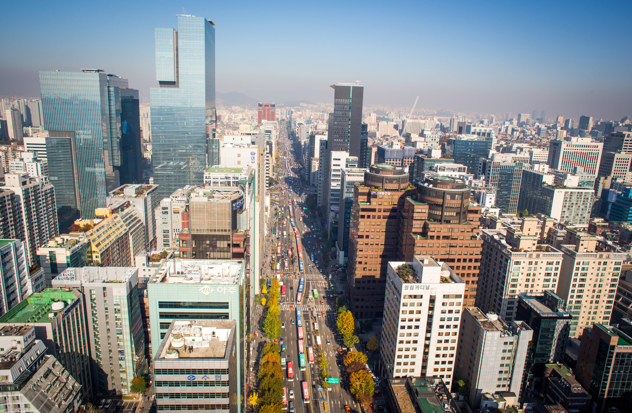
Photo: Korea Tourism Organization
One Seoul, Many Cities
Same city, different mornings: Gangnam Station is already packed at 8 a.m., while the cafes of Seongsu-dong barely stir before noon. On weekends, families spread picnic blankets across the Han River parks of Yeouido and Ttukseom, hikers climb Bukhansan and Gwanaksan, and — since autumn 2025 — the Hangang Bus ferries passengers along the river itself, offering a completely new way to see the city.
Seoul isn’t really one city. It’s 25 different neighborhoods sharing a single name. Choose the district that fits your plan, and Seoul suddenly becomes far more interesting.
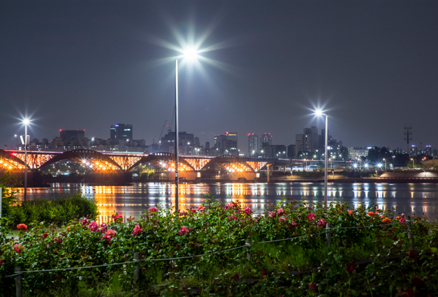
Photo: Korea Tourism Organization